|
<< Back to the main Local History page
A patchwork of fields is how we could describe the Ballydowd – Ballyowen area of the 1930s.
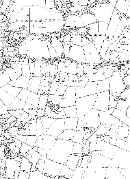
To the north of the map is St. Edmondsbury, adjoined by the old area of Woodville, , and Hermitage. Woodville was the site of Ballydowd Castle, which was later replaced by Woodville House. The modern estate of Woodville is actually on the southern side of the old Main Road.
Esker Lane, meandered its way southwards with dwellings such as Esker Villa, St. Anne's, Willsbrook House and Lodge, Beech Park , and Esker Lodge, until it reached the Glebe, in Esker.
The Ballydowd Inn, – now The Foxhunter – along the Main Road between Esker Lane and Lautoka , at the junction of Ballyowen Lane, , which again trails southwards to the Balgaddy, area. Along this route are Ballyowen Cottage, Ballyowen House, Ballyowen Cottage, , and Ballyowen Castle, – the remains of the latter are still to be seen at Eurospar Centre.
When this map was published, herds of dairy cows, and valuable horses graced this rich pastureland.
M.M.
|